Kununurra
Advertisement
By car
Kununurra is a mere 30km from the Northern Territory border, but a long way from anywhere else. The drive over vast distances, through some very isolated country to get there should not be taken lightly, though with a bit of forward planning the getting there can be a great trip in itself.
By plane
Kununurra airport , is 4km outside of town and has flights to regional centres as well as some charter and scenic flights. The airport is small but modern and the runway has one of the most scenic approaches you are likely to find. Taxis wait for every arriving flight and cost around $10 to town. Some hostels/hotels offer a free courtesy bus if you are staying with them. There isn’t a local bus or airport bus service into town.
By bus
- From Broome. Greyhound runs daily services virtually flying there in 14 hours.
- From Darwin, it's only about 9 hours.
- From Perth is theoretically possible, but if you are not insane before taking on the 48hr journey, you may be afterwards.
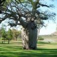
- Celebrity Tree Park, Old Darwin Rd (next to Lake Kununurra). Established in 1984, the park displays different species of trees planted by famous people during their visit to Kununurra. Despite the eminent provenance of the trees' placement here, they are really just trees in a park.
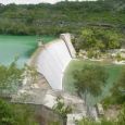
- Diversion Dam, (6km west of town on Victoria Hwy). This antiquated looking dam holds back Lake Kununurra on one side and feeds a steady trickle into the irrigation channels on the other. All kinds of massive iron pulleys, levers and mechanical doodads from an erstwhile grand engineering age can be seen as you drive slowly over the wall. A spray on white water continuously surges through one of its 20 gates next to a shady picnic area and boat ramp. A good place to cast a fishing line into the churning water during the dry season, but is sometimes submerged in the wet.
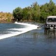
- Ivanhoe Crossing, Ivanhoe Rd (about 10km north of town out past the farms). Permanently submerged crossing over (or under) the Ord River. Popular with locals fishing for Barramundi, it's also a nice spot to have a BBQ or explore along the waters edge. As inviting at the water looks, taking a dip isn't advisable as freshwater crocs got in first, and they don't like to share. Crossing in a 4WD is possible when water levels are low, but during the wet season, the river swells to a torrent and makes the way impassable for all but the most foolhardy.
- Kelly's Knob, Kelly Rd (off Speargrass Rd). Visible from anywhere in town, Kelly's knob is the highest point (191m) for miles, making it the ideal place to get a wide view of the valley and surrounding ranges. A railed lookout area next to the carpark is a suitable vantage point to see all the main features. Those itching to see further can hop over the pitiful fence uphill from the carpark and follow a well worn trail along the hill face to the service stairs that lead to TV tower and the knob's peak.
-
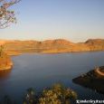
Lake Argyle, (drive 35km east on Victoria Hwy and turn at the sign just before the NT border). Literally the reason Kununurra is on the map; this enormous man made lake is about 70km out of town. Any superlative you care to think of fails to do justice to the size and beauty of what is here, but the odd four letter word usually enters the mind of most on arrival. Besides being dumbstruck with the spectacular landscape, you can also swim, hike or fish around the myriad of islands, bays and beaches. Cruise and fishing charter boats ply the waters and are a good way to explore the less easily accessible parts of the lake.
January - March
September - December


