Sabah
Advertisement
By Air
To get to Borneo from Kuala Lumpur, there are two airline companies that fly to Sabah and Sarawak. Malaysian Airlines (MAS) operates flights from several countries to major cities and towns in Borneo while Air Asia plies routes from Peninsular Malaysia to and around Borneo. The main airports in Borneo are the Kuching (Sarawak) and Kota Kinabalu (Sabah) Airports.
Major airports are also located in other towns and cities such as Miri, Sibu, Bintulu, Labuan and Lahad Datu. Some rural areas have air strips for communication as their terrain is inaccessible by car.
By Road
To travel between towns and cities in Borneo, there is a major highway called the Trans-Borneo which connects Kuching in Sarawak all the way through Brunei to Kota Kinabalu in Sabah. The highway is constantly being updated with new roads to connect to rural areas.
By River
Rivers are an integral part of Borneo’s transport system, especially in Sarawak where there are many large rivers. Sometimes, you need to ride a boat or ferry to get to certain places within Borneo, especially for visiting longhouse communities. In Sarawak, there are a total of 55 rivers which are used for transportation and communication between the coastal towns and inland areas. 50 percent of the time, the vessels are used to transport passengers while the rest are for timber. The Rajang River is the most used, with up to 500 boats and other vessels plying the route daily.
Advertisement
Kinabalu Park
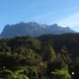
Kinabalu Park, the entrance to Mt Kinabalu, is located at 1,585 metres above sea level and is the main starting point for the summit trail that leads to the top of Mt Kinabalu. Its covers an area of 754 sq km and is made up of Mount Kinabalu, Mount Tambayukon and the foothills.
It was gazetted to preserve this valuable natural environment. The mountains have a fascinating geological history, taking 'just' a million years to form. The mighty Mount Kinabalu is actually a granite massif that was later thrust upwards through the crust of the surface.
Subsequent erosion removed thousands of feet of the overlying sand and mud stone, exposing this massif. During the Ice Age, glaciers running across the summit smoothed it out, but the jagged peaks that stood out above the ice surface remained unaffected, retaining the extremely ragged surfaces. This rugged mountain is the focal point of the National Park.
Turtle Island Park
Turtle Island Park consists of a number of uninhabited islands lying in the Sulu Sea, off the east coast of Sabah.The park comprises three small islands, Selingan, Gulisan and Bakungan Kechil. Selingan, the largest of the islands, houses the park's headquarters, a turtle hatchery, tourist accommodation and basic facilities. The other two islands are more for conservation activities.
Two species of turtles. Greens and Hawksbill are special festures of this park. Turtle landings usually occur after dusk. The park has a sensible policy of allowing visitors to see only one landing a night. This allows undisturbed nestings to go on throughout the night.
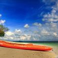
Whilst waiting for the evening's highlight, all that is left to do is to laze on the beach at sunset or snorkel. The west side of the island is ideal for this. It's clean, quiet, and offers some interesting coral and sea life. Wander around the island and you'll be surprised at how many turtles would have landed in the last few days; their tracks, like mini-tractors, remain in the sand for days.
The driest months and the calmest seas are between March and July. The peak egg laying season is July to October. The seas can get rough between October and February.
The nearest mainland town to the park is Sandakan. Your tour operator will organise a speedboat pick-up service to and from Turtle Island Park. It takes about one hours to reach the islands by boat.
Danum Valley
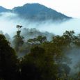
The Danum Valley Conservation Area, 83km south-west of Lahad Datu, is blessed with a startling diversity of tropical flora and fauna. This vast Eden-like basin is home to the rare Sumatran Rhinoceros, orang utans, gibbons, mousedeer and the beautiful clouded leopard. Some 270 species of birds have been recorded in the area. The Danum Field Research Centre is located within the confines of the 440 sq km forest reserve.
It also boasts one of the first eco-resorts in Sabah, known as the Borneo Rainforest Lodge. This comfortable resort has a restaurant, bar and comfortable chalets overlooking the Danum River. Jungle treks, river swimming, bird watching, night jungle tours and excursions to nearby logging sites and timber mills are some of the activities offered here.
Mabul Island
Mabul Island is reputed to be one of the best places for underwater macro-photography in the world. Located in the clear waters of the Celebes Sea off the mainland of Sabah, it is surrounded by gentle sloping reefs two to 40m deep.
Covering some 21 ha., it is considerably larger than the nearby Sipadan Island and is home to the Bajau Laut tribe, one of many ethnic groups in Sabah.
Diving is the main activity on this island, and it can be done all year round. Marine life that can be seen here includes sea horses, exotic starfish, fire gobies, crocodile fish, pipefish and snake eels. There are over eight popular dive spots, each with its own speciality.
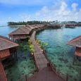
Three resorts cater to scuba divers -- two are on the island itself while one is on a converted oil rig platform about 500m offshore. All of the resorts provide day trips for their guests to the nearby Sipadan and Kapalai Islands.
Madai Caves
The Madai Caves are an important place for harvesting birds' nests. These nests are considered a delicacy and something of a medicine among the Chinese, and the export market is huge.
The village at the entrance of the largest cave comes alive twice a year when the Idahan tribe comes to harvest the birds' nests from various parts of the caves. It is a special communal event, almost like a festival.
The harvesting is a dramatic event with the men risking their lives to pry precious nests from the cave roof. Nowadays, the harvesters are hired. The Idahans have held their rights to the Madai Caves for over 20 generations.
To visit the caves, permission must be obtained from the Idahan elders. Visitors may visit the District Office in Lahad Datu town to make prior arrangements for entrance permission.
Lankayan Island
Lankayan Island is a virtually uninhabited island located in the Sulu Sea. This tiny island is covered by thick tropical jungle that is surrounded by smooth, white sand - the perfect getaway.
It has the only dive resort in Malaysia's Sulu Sea called the Lankayan Island Dive Resort and is one of the best spots for whale shark sightings. The location of the whale shark is usually indicated by flocks of seabirds screeching high above the placid surface. With luck, divers and snorkellers may get close to this gentle giant, although it won't stay close for long.
During the day you can witness black-tip sharks swimming about by the beach. At night, hawksbill and green turtles may be spotted coming to shore. Large stretches of beautiful hard and soft corals belonging to numerous genera can also be found here, the perfect habitat for colourful friendly fishes.
Among the 40 dive sites is Lankayan Wreck, where the remains of an ocean-going fishing boat can be explored. This wreck now hosts many different species of fish from small glassfish, harlequin ghost pipefish, painted frogfish to giant grouper and marbled stingrays.
Despite the remoteness, the island has all the amenities of a tropical resort. Visitors can stay in wooden bungalows that blend into the natural surroundings.
Indeed, Lankayan is not only for discerning divers but for anyone who appreciates the tranquility of a paradise island that offers beautiful sunrises, spectacular sunsets and magnificent seascapes.
Information not available
Information not available
Advertisement

