Kangra
Advertisement
Distance By Bus
From Destination Distance (KMS)
Delhi Dharamshala 525
Chandigarh Dharamshala 255
Jalandhar Dharamshala 170
Pathankot Dharamshala 88
Ludhiana Dharamshala 200
Amritsar Dharamshala 190
Jammu Dharamshala 210
Shimla Dharamshala 250
Manali Dharamshala 135
Una Dharamshala 125
Palampur Dharamshala 45
Baijnath Dharamshala 62
Distance of Sub-Div/ Tehsil from District HQ
Distance by Train
The nearest railway station is at Kangra, 20 KMs from Dharamshala connected to Pathankot through narrow gauge line. And the nearest broad gauge railway station is Pathankot which about 95 Km from Dharamshala.
The narrow gauge line from Pathankot passes through Kangra, Maranda(Palampur), Baijnath and reaches Joginder Nagar. The railway reservation facility is also available at Dharamshala. The schedule for these narrow gauge trains is given below:
Distance
Delhi Pathankot 485
Ambala Pathankot 287
Jammu Pathankot 101
By Air
The nearest Airport is at Gaggal, 13 Kms from Dharamshala and 8 Kms from Kangra Town.
KANGRA ART MUSEUM
Kangra Museum at DharamshalaThis treasure trove of the Kangra valleys arts, crafts and rich past, display artifacts that date back to the 5th Century. It includes a gallery of famous paintings and a representative collection of sculptures, pottery and anthropological items. Shamiyanas and local dresses used by local royalty, old carved doors, jail and pndals are also on display. Coins jewellery and manuscripts are included. A section houses the works of conteporary artists, sculptures and photographers
MARTYR'S MAMORIAL
Martyr's Mamorial,DharamshalaSet amidst beautiful surroundings, this memorial was built in 1972, near the entry point to Dharamshala in Civil Lines. The war memorial was built to commemorate the memory of soldiers and officiers of Kangra district who fought valiantly for the defence of Motherland in INDO-CHINA(1962) and INDO-PAK wars(1947-48,1965 & 1971) and during some peace operations under United Nations Auspicies.
Features of the memorial are its three curved walls in black marble each 20 feet long and 24 feet high bearing the names of 1042 martyrs on five of its faces with a mural on the sixth. Rising from a circular shallow pool having a central bowl and 21 water jets, these walls signify the three wings of the "Armed Forces". Their curved shape indicates the continuity and onward movement of human and national life. On selected evenings in a week, the monument is flood lit and the fountains burst forth in full splendor.
Outside the gate of the memorial are a disused Pattan Tank captured in 1971, INDO-PAK war and a Gnat, a light jet aeroplane, successfully used by the Indian Air Force in the same war. The entire area looks like a fairyland. Top (Click here to go)
MURAL
Mural At Martyr's MamorialThe Mural symbolizes the flame of National Freedom. A stout arm is holding the flame aloft, showing how our heroes are making determined efforts to keep it ever high and ever burning and in doing so they are achieving martyrdom. The garlands and medals around them represent Nation's gratitude to them. In nutshell, the mural depicts how the martyrs are upholding the freedom of their Motherland by sacrificing their lives so that their countrymen may be able to live freely.
TRUIND
Triund PeaksFor adventurous people nothing can be more enjoyable than a 9-km climb from McLeod Ganj to Triund located at a height of 2,827 metres above sea level. Here you get a face to face view of towering snow-clad Dhaula Dhar. On a clear day you can also have a spell-bounding view of hills and valleys below.In spring the hill slopes of the path leading from McLeod Ganj to Triund are abloom with lots of wild flowers like the flame of the forest, holly hock, gladioli, hydrangea and so on.
For weary travellers there is a forest rest house at Triund (cabins for night stay are booked by the Divisional Forest Officer in lower Dharamshala) to rest and sojourn. Tour operators can arrange rest house bookings on their own too. Since the spot is ideal for hang-gliding, a westerner used to enjoy flying down from Triund on his hang glider till some time back. Lately, no one has emulated his example. Five kilometres above Triund, the snowline starts at a place called Laka, presenting a breath-taking view of the snow above and the Kangra valley below. Top (Click here to go)
KARERI LAKE
Kareri LakeLocated at a distance of 33 km from Dharamshala and at an altitude of 1,983 metres above the sea level., Kareri village is set amidst beautiful settings.13 km from here lies the impressive Kareri lake 3,048 metres above the sea level amidst green meadows, oak and pine trees making it an idyllic spot to visit. At Kareri the visitors can stay in the forest rest house, for which prior reservation is needed from the Divisional Forest Officer, Dharamshala near head post office.
DAL LAKE
Dal LakeEleven kilometers above Dharamshala and next to the Tibetan Children Village is a miniature oval-shaped artificial lake called Dal lake, rimmed by fir trees. Though small in area, this lake has a charm of its own solely due to its surrounding forest and hills. Taking a dip in the lake is considered sacred. Devotees believe that a bath in the lake fulfills any boon asked from Lord Shiva at that time.
DHARAMKOT
1 Kilometer above McLeod Ganj a village called Dharamkot inhabited by the Gaddis (hill tribals) nestles amidst scenic beauty at 2,100 metres above the sea level. Besides offering a panoramic view of the Dhaula Dhar range of mountains, Kangra valley and the Pong Dam, the village once had a gallery of paintings of a well-known English painter "A.W.Hallot". Today Dharamkot is a favourite picnic spot. Top (Click here to go)
NADDI
At 2,000 metres above the sea level and about two kilometres from Mcleod Ganj, a modern picnic spot is developing fast at Naddi. It is connected with a metalled motorable road.It is the only place in Dharamshala from where an open view of mountains and wide valleys on Dhaula Dhar's southern side can be seen. It is also a starting point for a trek to Kareri lake, Guna Temple and Triund.There is an International School called "Sahaj International School", where the children are educated keeping in view the Indian way of life besides all essential school subjects
MCLEODGANJ
McLeod GanjViewed from Mcleod Ganj, the Kangra valley sprawls below as far as the eye can see. So fantastic and expansive is the view of kangra valley from upper Dharamshala (McLeod Ganj) that an Englishman Barnen went ruptures over it. His description in the Kangra gazetteer is worth reading : 'No scenery, in my opinion persents such sublime and delightful contrast'. At 2,000 metres above sea level, McLeod Ganj is a place pulsating with life. it has a delightful mixture of eastern, western and Buddhist cultures, reflected in the people, in the shrines of worship and in its very name.
WATER FALL
Water Fall at Bhagsu Nag2 kilometers away from McLeod Ganj and connected to with a mettalled motorable road, is an ancient temple of Bhagsu Nag. About 1 km there is a small but lovely waterfall close to the temple, which is enough to sooth one's eyes and mind. Above the waterfall, the mountain side has a lot of slate quarries. It is a perfect site for picnics and recreation.
Top (Click here to go)
CHURCH
St.John Church in McLeod Ganj7 km upward from Dharamshala, between Forsyth Ganj and Mcleod Ganj lies the charming St. John's Church built with dressed stone and having beautiful stained glass windows, popularly called, the church of St. John in Wilderness. Under the shed of deodar branches, a memorial has been erected over the body of the then British Viceroy of India, Lord Elgin who died in Dharamshala in 1863. There is a well tended old graveyard on the grassy sloves.
The church is small in size and was built in 1852 in the Gothic style. Its tapering high windows, the front and back sides of its building all seem to be in perfect harmony with the deodar grove which is a home to lots of monkeys, baboons and birds. In 1905 earthquake, the bellfry of the church was completely destroyed. However, the rest of the building escaped damage. A new bell (built in 1915) was brought from England and installed outside in the compound of the church. The church witnessed a special event in 1992 when visitors from 39 countries paricipated in its service. Top (Click here to go)
KANGRA FORT
Kangra FortThe historic fort of kangra was built by BhumaChand the founder of the Katoch Dynasty. This fort had been the centre of attraction for the rulers of Northern India. Since Long Time the first attack on the fort was made by Raja of Kashmir, Shreshta in A.D.470. In 1009 Muhammad Gazni Looted the Kangra Fort. He Carried with him 7 Lakh gold Coins , 28 tonne utensils mode of Gold and Silver and 8 tonnes of Diamond and Pearls. In 1337 Muhammad Tughlaq and in 1357 Feroze Shah captured the Kangra Fort. In 1540 the fort was captured by Khan Jahan a commander of Sher Shah Suri. In 1620 Jehangir occupied the Kangra Fort and came to see it in 1622. In 1781 it came under the control of Jassa Singh Kanhaya. In 1786 Maharaja Sansar Chand took control of the fort. In 1846 the Kangra Fort fell into the hands of the British. The Fort is located on the Banks of the River Ban Ganga. In the foreyard of the Fort are the temples of Laxmi Narayan and Adinath dedicated to Jainism. Inside the Fort are two ponds one of them is called Kapoor Sagar. At prsent the fort is under the control of the Archaeological Survey of India. It was badly damaged in the 1905 earthquake. Top (Click here to go)
NURPUR FORT
Is located on 32 18 north and 75 55 eat at an altitude of 2125 ft on the banks of the river jabbar.The first reference of nurpur is found in the writings of the historian of the period of Akbar. He reffered to the king of Nurpur by the title of Zamindar of Mau and Paithan. The ancient fort of Mau was demolished by Shahjahan. To the ancient it was known as Dhameri.It was renamed by raja Basu as a mask of Respect to the mugjhal empror Shahjahan and empress noorjahan. it is famous for an old fort and a temple of Brij Raj Bihari. The image according to legend was worshipped by Meera Bai. The fort is in ruins now but still has some carved relief work on stone.
PONG DAM
Maharana Pratap LakeA beautiful Reservoir named the Maharana Prathap Sagar in Distt. kangra also known as the pong dam plays host to a wide variety of water sports like Sailing, Water Skiing, Rowing, etc.. This reservoir is situated at a height of about 450 mtrs, covering an area of about 45,000 Hectares approx. This palce is now a wildlife sanctuary with over 200 species of migratory birds having been spotted in and around the reservoir. You can visit this Place from Masroor, Pathankot and Nurpur. This Place therefore serves a dual purpose for the adventurous tourists.
Top (Click here to go)
BIR/BILLING
GlidingThis is one of the most beautiful jeep able routes in the Kangra valley situated at a height of about 9500 ft from the MSL. 35Kms from Palampur is Bir Town known for the Buddhist monasteries and 14 kms from here is the famous aero sport site of Billing. Upto Bir town you can travel by any vehicle. The 14 km distance from bir to billing is actually a rock road, whose rock cutting was done way back in 1962. It is advisable that this distance be covered either by foot or if by a vehicle it should be any 4x4 vehicle like the Gypsy or the Mahindra 4x4. At billing there is only a Guest house of the Forest Dept. being looked after by a caretaker named "Thakur". This guest house can be booked from bir in advance for over night stays. With food stock being a scarcity in this part of the Kangra valley your only link to the outside world is the care taker of the Guest House "Thakur". This place is the originating point for hang and para gliders. You can fly upto chamba from here. The ariel view of the chamba and kangra valleys are really breathtaking. Top (Click here to go)
GOPALPUR ZOO
Gopal Pur ZooLying on Dharamshala-Palampur road, wildlife department of H.P Goverment has established a zoo at Gopalpur spread over 12.5 hectares of thick forest. Animals which can be seen here include Asiatic Lion, Himalayan black bear,(a major attraction with the tourists), Leopard, Sambar, hog deer, barking deer, red fox, angora rabbits and so on.
ART GALEERY
Well known Indian portrait painter late Sardar Sobha Singh's art gallery still draws visitors each day. Punjabi playwright Mrs. Norah Richard also lived and died here. The Punjabi University holds an annual competition in Andretta in honour of Norah Richard in which plays are staged in the open. many living artists have made this village their home due to its scenic location, and quietness, as it is far away from noisy roads.
TEA GARDENS
Tea GardensTea in Kangra valley was introduced in 1854. When "Holta" tea estate was set i[ (4200 ft above the MSL). After the devastating earthquake of 1905 annihilating both man and plantation, the tea prodoction lost its paramount position, however, the scene has changed with the setting up of the Council of Scientific and Industrial Research (CSIR), Palampur Complex where scientists are striving to produce tea Production of the one popular Kangra Tea through the scientific methods, using tissue culture techniques, producing numerous"Somatic embryo's encapulated into a gelatine like substance,sodium alginate to form a bead like structure called an artifical or synthetic seed. And hence the production has shown a tremendous increase. From 84 kg of green tea leaves per hectare to 200 kgs of green leaves per hectaare. A new concept, the "orgnic tea farming". green tea without using any chemicals such as pesticides and fertilizers has come into operation to explore the much needed export potentiality.
in th e tea gardens, the chemical control of grass weeds is quiet necessary, particularly during the early years of establisment, aafter which the bushes attain a good spread and dense canopy, which supresses the weed growth ina natural way. Out of the various grass weeds in the estates in the Kangra valley the that is found in abundance.
The entire tea production of Himachal pradesh is produced in kangra especially in the Palampur valley. It was docotor william jameson who had itroduced the chinese green tea, had brought the seeds from the kumaon hills,to nagrota and Bhawarna hills first. After testing and trying period of more than 75 years, the four co operative tea factories at Palampur , Bir, Sidhbari and Baijnath encouraged the disillusioned planters to produce quality tea and it is fetching good price now. Top (Click here to go)
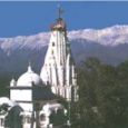
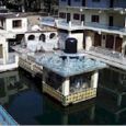
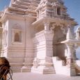
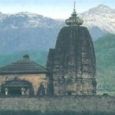
MASROOR TEMPLEMasroor Temple The famous Masroor temple complex in Himachal Pradesh lies nearly 22 km from Kangra and 40 Kms from Dharamshala. It lies to the north-east of the village, a rocky sandstone ridge, the main axis of which runs from north-west to south-east. An outcrop of sandstone rock, the highest central portion of which has been separated from the rest by two transverse and more or less parallel cuttings, it accentuates the crest of the hill. In the intervening portions of the rocks are sculpted a series of temples unique in the entire Himalayan region and comparable to the monolithic temples of Mahabalipuram, Ellora and Dhamnar caves.In the centre of the complex stands the principal and most elaborately carved shrine - the Thakurdwara - enshrining black stone images of Ram, Lakshman and Sita facing east. The Masroor temple has an adjoining tank - large and rectangular - hewn from sandstone. It is nearly 50 m in length and is reputed to have water throughout the year.
MANNUNI LAKE
Manuni Lake8 km away from Dharamshala, Aghanjar Mahadev Temple and 5 km trek to Natural and God gifted lake named as Manuni Lake.
Information not available


