Gudalur
Advertisement
There are five common Ghat Roads leading into the Nilgiris:
The Kotagiri Ghat is the oldest known route into the Nilgiris. It approximately follows the route taken by John Sullivan on his discovery trips in 1819. The distance between Mettupalayam and Kotagiri on this road is 33 km and it has only 4 hair pin bends. This road is part of SH15. It is slightly less travelled as it is a slightly longer route from Mettupalayam to Ooty than the route via Coonoor, though as of 2006 the road condition is superior to the Coonoor Ghat. It is also statistically less vulnerable to landslips. It is possible to divert from this route to Coonoor. There is a link from Aravenu to Bandishola.
Travellers reach Mettupalayam from Coimbatore via National Highway 67. There are also other routes to Mettupalayam for travelers from Northern Tamil Nadu which avoid the congestion of Coimbatore City. One of these is via Annur.
[edit] Coonoor Ghat (National Highway 67)
Route: Coimbatore-Mettupalayam-Burliar-Coonoor-Ooty
This is also known as the Kallar Ghat, as it follows the valley of the Kallar and Coonoor rivers. It is by far the most travelled of all the Ghat Roads as it is the main access from the home state of Tamil Nadu. It has 14 numbered Hairpin bends and was recently (c.2003) taken over to be owned and maintained by the National Highways Authority of India and is now part of NH67. A toll must be paid for vehicles entering the Nilgiris district at Burliar. This also provides a rest stop on this route.
Due to it largely following one of the primary drainage basins in the area it is frequented by severe landslips, often closing it for several days. As of 2006 the road is still in a terrible state of repair, and can not be yet considered a "National Highway".
[edit] Gudalur Ghat (National Highway 212 and 67)
Route: Gundlupet-Bandipur-Mudumalai-Gudalur-Ooty
This is also simply known as the Mysore Ghat or Mysore Road. It is the main access route from Karnataka and Kerala. Travellers from Karnataka reach Gundlupet via the Mysore-Gundlupet NAtional Highway 212 and travellers from Kerala reach Gudalur via the continuation of National Highway 212 from Kozhikode-Sultans Battery.
One traveller commented about this route: "The road from Mysore is arguably the most scenic with a long stretch that runs through the Mudumalai National Park, and if travelling in the early mornings or late evenings, you definitely will spot wildlife feeding along the road, even spot the odd carnivore. There are majestic stands of Eucalyptus amidst well tended tea estates as you near Gudalur, and then you drive past the Pykara Dam and Pykara falls".
As with the Coonoor Ghat, from 2003-2006 this route is in a terrible state of repair. This route towards Gudalur from Ooty is the continuation of the same "National Highway" NH67 which makes up the Coonoor Ghat. National Highway 67 terminates in Gudulur where it joins onto National Highway 212 towards Gundlupet.
[edit] Sigur Ghat (State Highway 67)
Route: Mudumalai-Kalhatti-Ooty
This is also known as Kalhatti Ghat (or simply 'Steep Ghat'). There is a short cut-branch off the Gudalur ghat at Theppakadu in Mudumalai. This route saves approx. 30 km on the standard Gudalur route, though it is by far the steepest route and is limited to short wheel based, high power vehicles only. It has 36 hairpin bends and is closed overnight.
[edit] Manjur Ghat
Route: Coimbatore-Karamadai-Geddai-Manjur-Ooty
This is a smaller ghat for local traffic, and is used as a backup road in the rare occasion that both the Coonoor Ghat and the Kotagiri Ghat are closed. The road is narrow and steep with several hairpin bends. At Geddai, half way up the ghat at 1,885 feet (575 m), there is a hydroelectric power station [1]. From Manjur, at the top of the ghat, the distance is equidistant to either Ooty or Coonoor via smaller district roads.
Tourist attractions
* Needle Rock View Point (Ooshi Malai/Soochi Malai): It is 7 km on the way to Ooty - Gudalur. From here one can see almost every part of Gudalur and Mudumalai Wildlife Sanctuary, Gudalur town, Bandipur and parts of Mysore. On the other side, you can see parts of Kerala. You can also see a mountain popularly known as Sleeping Beauty (also called Aanakkallu) which is exactly in the shape of a sleeping woman.
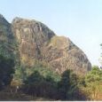
* Frog Hill View: The hill is in the shape of a huge frog. Frog hill view point is 9 km. from Gudalur on the way to Ooty. From here, one can see a gigantic frog shape of a hill.
* Mudumalai Wild Life Sanctuary is in Gudalur. mudumalai starts 5 km from gudalur town
* Numbalakottai Vimalagiri : 4 km. from Gudalur. A shrine of Vettakarappan (Lord of the hunts) with sub-shrine built in Kerala style is here. Wynad scenery is visible from here. The temple was a property of Nilambur Kovilagam and the festival is conducted once in a year by the Kovilagam trust under the guidance of the Kovilagam. The way to Nambalakottai is via Kalampuzha.
* Kalampuzha: This is a small place located near to Gudalur Bus Stand. Kalampuzha is sweet place where people live in peace and harmony. There are two NGO's NAVA(Adivasi Trust) and PALM2 located in this place.NAVA concentrates only in the welfare of the first peoples of Gudalur(Adivasis). PALM2 NGO is headed by Ms.Natascha Sennema from The Netherlands who dedicated herself for the PALM 2. This NGO trains people to indulge in several agricultural and Income generation activities. This NGO is different from other NGOs in its Particiaptory and holistic approach. The NGO has 2 Umbrella organisation (PLF,20 people's Community Based Organisations (CBO) and 350 Self Help groups. Several group members were trained in Cottage industries, Tailoring, Banana chips making, Bakery and Indian savories. Ciji Varghese working in PALM2 has a great idea in Aqua Culture, Ornamental fishery and edible water fish.
* Manvayal/Bospara: This is a small satellite town 8 km from Gudalur, and is adjacent to the Mudumalai Tiger Reserve. The people here are mainly small tea growers and are mainly engaged in agricultural activities. The ancestors of this village migrated from Thiruvithamkur and other parts of Kerala some 50 years ago. Ironically, the original name Manvayal was that of a small Kattunayakan Tribal village. "Seva Bharathi"(NGO)is indulged more than 'two hundread' seva works in this area.
* Nelliyalam: 20 km. from Gudalur. A few ruins of historical Ummatur dynasty can be seen here. There are ruins of a Fort which was the seat of the erstwhile Nelliyalam Rani.
* Ponneni: There is a Vishnu Temple where Utsavam takes place only once in 12 years. It was under the control of the Nilambur Kovilakam but it is not maintained properly after the 'Gudalur Janmam abolishment and Conversion Act, 1969' was passed by the Tamil Nadu State government.
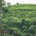
* Pandalur: Capital of Pandalur Taluka. There are many tea plantations.
* Vimalagiri: The capital of Mothavayal panchayat. It is a fully literate village.
* Singara and Moyar: Underground Power houses under the control of Tamil Nadu State Electricity Board.
* Cherangode: There is a shrine dedicated to Velankanni Matha. This is a pilgrims' centre.
* Cherambady 35 km. from Gudalur. It is extreme western corner which has plantations and mica mines. Sultan battery is very near.
* Kunnalady: Kunnalady is a pilgrim centre of Malayalees as well as Tamils. It is a centre of Tea Leaves business. Bekky is near by. The people here are mainly tea planters and life depends on the rise and fall of tea leaf value. There is a church in Kunnalady and another in Bekky. Bekky Matha Church is ancient and very famous for its feast called 'perunnal'and the land for this church is provided by Jacob Padinjaremuriyil to Mananthavadi Diocese. There is a temple Anchmbalam in kunnalady and its 'Utsavam' is very famous. Ammankavu is nearby. Amman Kavu Utsavam is a time for the tribals to meet in a year.
* Nellakotta: It is 15 km from Gudalur. A dilapidated fort is there.
* Hanging Bridges : Located on the way to Mudumalai wildlife sanctuary. It is 7 km from Gudalur.
* Genepool Garden: It is located at 10 km from Gudalur in a place called Nadugani. It has a variety of species from all over the world.
* Kariyasholai: A beautiful village encircled with forest where one half cultivated tea plantation, vanilla, coffee, cardamom etc., The queen of hills has her daughter NEEDLE ROCK placed to the east top of the village which really makes the village a heavenly jorn. Chelakkunnu just one km away is a beautiful forest-cum-village of thodas, kurumaas, paniyaas etc. One can often see elephants wandering, deer rover, beautiful wild life on a stream walk at the location.
* Devala: A small town on the way to Pandalur from Gudalur at 18th km has the second highest rainfall in India.
* Valat Mahavishnu Temple at Ambalamoola, was known from the ancient and traditional palm leaf testimonials and learned astrologists who conducted Ashtta Mangalya Deva Prasnam in the temple that the Valat MahaVishnu Temple(Narasimhavatar) was established during the reign of Chera Kings about 1500 years ago. The Chera Administrators known as Nayakans entrusted an ancient family named Valat Tharavad to execute and carry out daily pooja and related rites without any hindrance and for which total expenditure were also met by the Nayakas. Accordingly the Valat family maintained the temple till 1975 and expressed their inconvenience to continue their execution there after for want of means and ways.
* Cherangode Swami Malai: A tourist hill, lake, located in Pandalur-Kolappally-Ayyankolly road.
* Velleri River- Located in Silver Jubilee road near, Ambalamoola.
Information not available


