Charlottesville
Advertisement
By plane
Charlottesville Albemarle Airport, (IATA: CHO). The closest airport to Charlottesville. This airport is approximately 10 miles from downtown, so a rental car (Avis, Hertz, or National), taxi, or hotel courtesy shuttle is required. It is often more economical to fly into Washington Dulles (IATA: IAD) or Richmond (IATA: RIC). Richmond is 80 miles away and Dulles is over 100 miles away. Rental cars are available at each and the drive to Charlottesville is straightforward.
By train
Amtrak, Charlottesville is on the Cardinal, Crescent, and Northeast Regional routes. Two or three northbound and two or three southbound trains stop in Charlottesville each day (the number depends on the day). The station is on West Main Street, about halfway between the Downtown Mall and the University (3/4 mile to each), but within walking distance of several resturants. Plan to call for taxi service or take the CTS bus or trolley if you are not walking.
By car
The major highways leading into Charlottesville are US-29 and I-64. I-64 is a four-lane interstate leading to Charlottesville from east and west. There is rarely traffic on I-64 near Charlottesville, and the only major hill is crossing Afton Mountain, about 30 minutes west of town. US-29 is an extremely variable road. To the south, it is a four-lane road with frequent curves and at-grade crossings, but few traffic lights. To the north, the road alternates between being a four-lane commercial center with frequent traffic lights and buisnesses and being more similar to US-29 south of town. Traffic on US-29 north of town can be slow or dense at rush hour and around special events in Charlottesville, but speeds below 25mph are rare.
Travel times from nearby cities are:
Staunton, about 45 minutes.
Richmond, a little over an hour.
Washington, D.C., between 2 and 2.5 hours. The trip is approximately 110 miles.
Roanoke, about 2 hours.
By bus
Greyhound, The bus station is on West Main Street, about two blocks east of the Amtrak station. If you are traveling to or from Washington, DC, the train is generally faster, cleaner, and more comfortable than the bus.
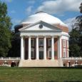
The University of Virginia, AKA "Mr. Jefferson's University." Quite possibly the most beautiful college campus on this side of the Atlantic. Walk around the university and visit the Lawn and the Rotunda.
The University of Virginia, AKA "Mr. Jefferson's University." Quite possibly the most beautiful college campus on this side of the Atlantic. Walk around the university and visit the Lawn and the Rotunda.
Monticello, the residence of Thomas Jefferson. The grounds include the house itself, the gardens, servant quarters, and Thomas Jefferson's grave. Open daily, $22 for adults, $8 children 6 - 11. Annual Pass $50.
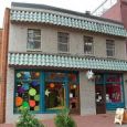
The Downtown Mall. Several blocks in downtown Charlottesville have been closed off to traffic, creating a pedestrian-friendly area full of shops and resturants. The old brick buildings, ecclectic stores, and people make this a great place to walk around. Just north of the Downtown Mall on Park Street is the town hall and some of the oldest buildings in town.
The Virginia Discovery Museum, on the Downtown Mall, has a variety of child- and family-oriented exhibits. Closed Monday, open until 5PM other days. Admission is $4 for all ages.
Dazzling fall colors. For the best sights in the Fall, drive into the hills south of town, or out US-250 West toward Afton Mountain. Skyline Drive and the Blue Ridge Parkway, west of town off US-250 or I-64, offer some of the best views.
January - March
November - December


