Member / Vendor Login

Andermatt

Country:
Switzerland
State:
Switzerland (General)
City:
Andermatt
Type of Location:
Multiple
About Location

Advertisement


Places to Visit
How to Reach

By car
There are roads in all four cardinal directions to Andermatt, and being a bit off the beaten track, driving there may be an alternative. The town is surrounded by mountain passes, and you need to cross at least one in order to get into the town. The highest of them, Furka to the west is situated at more than 2400 meters and he Andermatt itself more than 1400 meters (almost one mile) over the sea level. Driving through alpine passes is a great experience and the views are fantastic. However remember that the engine heats up when ascending and the brakes when descending.

By train
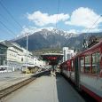
Swiss national railways SBB operates local trains to Andermatt from Davos Platz, Göschenen and Visp. The Glacier Express from Zermatt to St.Moritz also stops at Andermatt.

By plane
There is no passenger airport in the town. International passengers often arrive in Zürich.

Key places to visit
Furka art, Rhône Glacier, Handegg Falls, Devil's Bridge

Advertisement


Places to Visit

Furka art, Since 1983 the Swiss art exhibitor Marc Hostettler has invited artists to show their "Furka art" on the Furka pass every spring. Nature determines the end of the event, the first snow being the signal to dismantle the exhibition. Among the artists who have shown work here are Rémy Zaugg, Gianni Colombo, Per Kirkeby, Stanley Brown, Caniel Buren and Ian Hamilton Finlay.

Rhône Glacier,  At the head of the valley outside Gletsch, the Furka road crosses the narrow-gauge Furka railroad (now closed), of the line from Lake Geneva to Lake Constance by way of the Rhône and Rhine valleys ("Glacier express" from Zermatt to St Moritz). The line reopened as far as Tiefenbach in 1992, Gletsch in 1994 and Oberwald in 1998. Since 1982 a tunnel (15.4km/9.5mi) has replaced this section of the line. The road then crosses the Muttbach bridge and climbs steeply (five hairpin bends) up the north side of the valley, with beautiful views of the Rhône glacier and of Gletsch far below. In 7km/4mi the park lot of the Belvedere restaurant (2,272 m/7,454ft), is reached. From here it is only a few minutes' walk to the Rhône glacier, between the


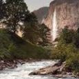
Handegg Falls, After passing the Handegg I hydro-electric station, the Grimsel Road takes two sharp bends and continues up through a further stretch of forest to the Handegg (Handeck) saddle, 150 m/492ft higher up. From a wider length of road there is a view of the Handegg falls, in which the gray-green waters of the Aare mingle with the silvery Aerlenbach, emerging below the road, and plunge into the chasm 46 m/151ft below. Soon after this, off the road to the right, is the Hotel Handeck (1,404 m/4,607ft). From here a cableway (for industrial use only) ascends the east side of the valley to the Gelmersee (1,849 m/6,067ft), an artificial lake formed by a dam 35 m/115ft high. The Grimsel road follows the valley bottom, strewn with boulders, and then
winds its way, with sharp bends, up the granite mountainside, worn smooth by the glaciers, to the Kunzentännlen Alp (1,616 m/5,302ft), where the last firs disappear, giving place to dwarf pines and rhododendrons. To the right, below, is the Handegg I hydro-electric station with its lake; to the left, higher up, the Gerstin glacier; straight ahead the dam of the Räterichsboden reservoir, up to which the road now winds its way (one hairpin bend).
 
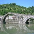
Devil's Bridge,  Road 2 runs north up the wide Urseren valley (Bear Hunters' Valley), a massive Alpine trough flanked by high mountains, some of them snow-capped, and by scree-covered slopes, and watered by the streams which feed the Reuss. The road crosses the Devil's Bridge (Teufelsbrücke 1,402 m/4,600ft), built in 1955-56, which spans the Reuss at a waterfall 30 m/98ft high. The bridge, 86 m/282ft long, inherited its name from an old 15th C. bridle-path bridge at the same spot. A stone cross 12 m/39ft high commemorates the fighting in September 1799, when General Suvorov's Russians, coming from the St Gotthard pass, defeated the French force which attempted to bar their way. To the right, on the old road, is the Teufelsbrücke restaurant.
Right Time to Visit

January - March
October - December
Temperature

Information not available


Advertisement


View Map